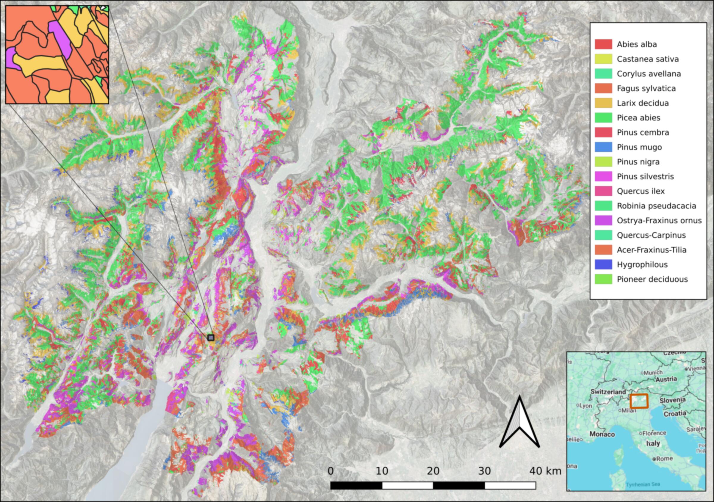
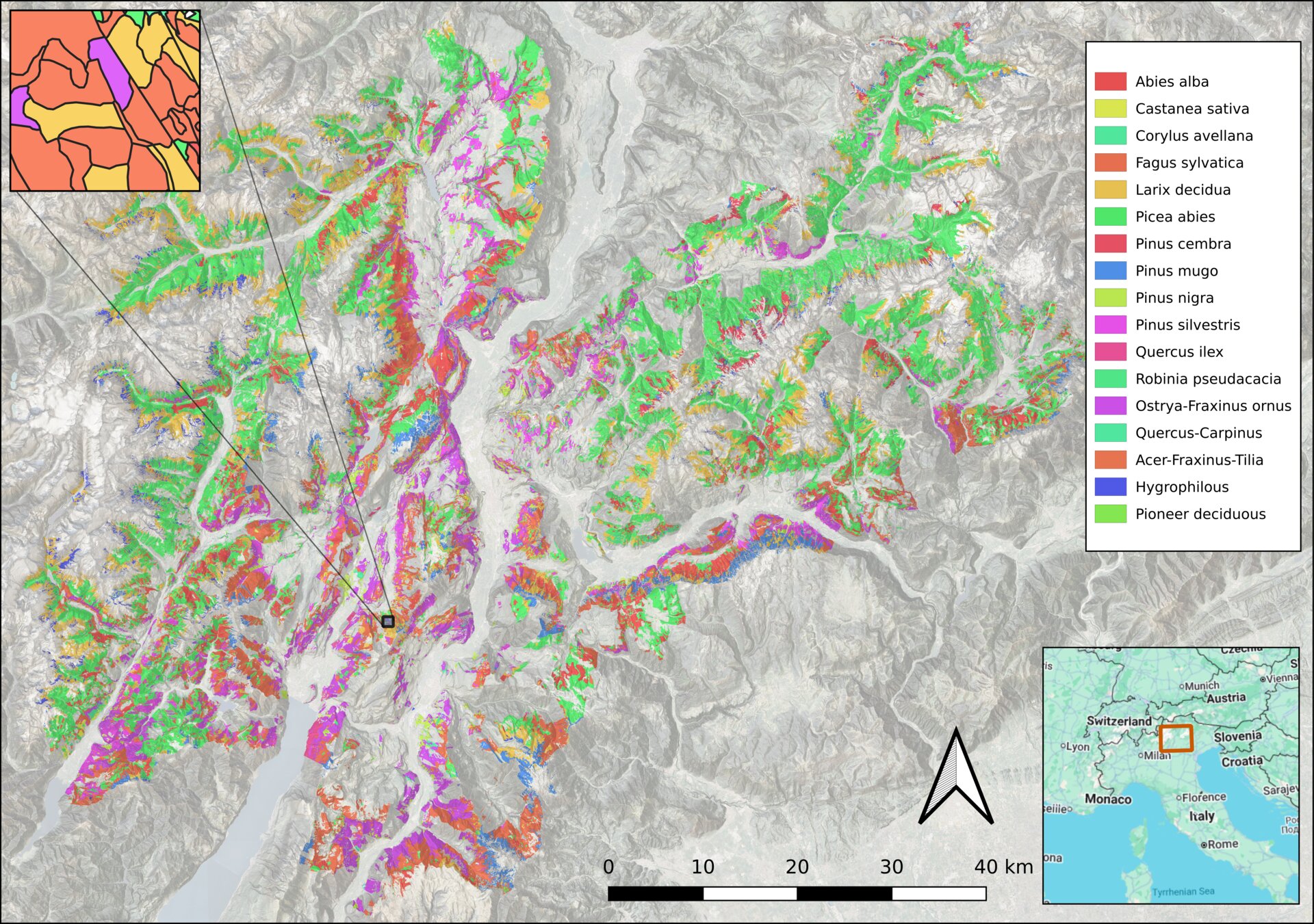
University of Cambridge

Mapping Earth's Habitats
with Foundation Models

We use geospatial AI to create fine-grained, species-level maps of the world's ecosystems — from Alpine forests to tropical biomes — enabling scalable biodiversity monitoring and evidence-based conservation.

The Challenge

There is still no accurate, fine-grained, globally consistent map of the world's remaining natural and human-modified habitats. This data gap hampers conservation planning, biodiversity accounting, and efforts to track the effectiveness of restoration programmes worldwide.

Coarse Existing Maps

Current global habitat maps lack the resolution and ecological detail needed for species-level conservation assessment.

Static & Outdated

Existing maps are expensive to update, dependent on input data quality, and cannot track rapid ecological changes.
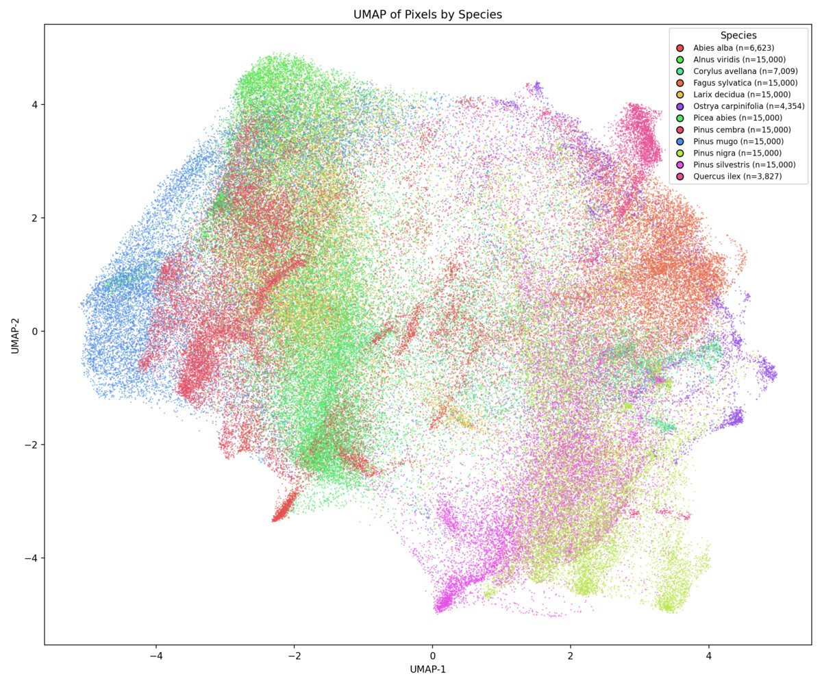
Label Scarcity

Field surveys are costly and sparse. Traditional remote sensing requires extensive hand-crafted features and labelled training data.

Our Approach

Geospatial foundation models — large AI systems pre-trained on petabytes of satellite imagery — learn rich, information-dense representations of the Earth's surface. We leverage these embeddings to classify habitats and species at 10 m resolution with minimal labelled data.

Satellite Imagery

Multi-sensor archives (Sentinel-1/2, global coverage)

Foundation Models

Tessera & AlphaEarth pre-trained embeddings

Ecological Labels

Forest inventories, vegetation plots, field data

Habitat & Species Maps

10 m resolution, annual coverage

10 m

Spatial resolution

18

Species classes mapped

2

Foundation models tested

6+

Regional projects

Featured Work

From species-level mapping in the Italian Alps to continent-scale habitat classification across the tropics.

Embedding Structure

Foundation Models Encode Ecological Meaning

UMAP projections of Tessera embeddings reveal that the learned representations naturally separate tree species and genera without any ecological supervision. Conifer and broadleaf species form distinct clusters, reflecting functional and taxonomic groupings.

Explore the full analysis
UMAP projection of Tessera embeddings colored by tree species